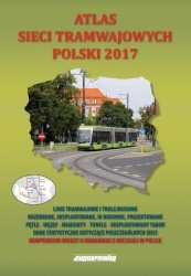
ATLAS SIECI TRAMWAJOWYCH POLSKI 2017 
Koleje » Atlasy i mapy|Komunikacja miejska » Autobusy i trolejbusy |Komunikacja miejska » Tramwaje
| Opis produktu | |
| Autor | M. Stiasny, Z. Danyluk |
|---|---|
| Wydawca | Eurosprinter |
| Wydanie | pierwsze |
| ISBN | 978-83-63652-25-8 |
| Stron | 172 |
| Format | A4 |
| Oprawa | twarda |
| Ilość zdjęć | 164 |
| Waga | 1,2 |
| Premiera | 08.11.2017 |
| Summary |   |
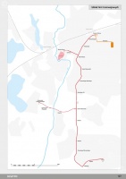
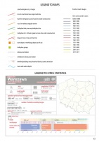
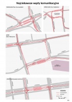
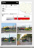
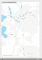
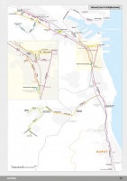
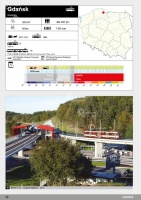
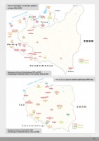
Atlas sieci tramwajowych Polski 2017 to kolejna edycja obszernego i profesjonalnego opracowania kartograficznego dotyczącego systemów tramwajowych na terenie Polski. Obejmuje zarówno miasta, w których obecnie eksploatowane są sieci tramwajowe, jak również sieci zlikwidowane lub pozostające poza dzisiejszymi granicami Polski (Lwów, Wilno). Kilkadziesiąt szczegółowych map ilustruje rozwój sieci tramwajowych w poszczególnych miastach od czasów tramwajów konnych do dnia dzisiejszego. Atlas sieci tramwajowych Polski 2017 może pełnić również rolę przewodnika po współczesnych systemach tramwajowych. Pozwalają na to mapy obecnie funkcjonujących sieci tramwajowych zawierające również dodatkową treść turystyczną. Mimo iż tytuł atlasu wspomina tylko o tramwajach, czytelnik znajdzie w nim równie bogate kompendium wiedzy o sieciach trolejbusowych. Opracowanie wzbogacone jest zbiorem starannie dobranych 164 zdjęć oraz informacjami statystycznymi o każdym z opisywanych miast. Wszystkie te elementy pozwolą czytelnikowi w przejrzysty sposób zapoznać się z licznymi aspektami rozwoju i funkcjonowania sieci tramwajowych i trolejbusowych oraz porównania ich ze sobą bez konieczności przeszukiwania i analizowania innych opracowań. Legendy przygotowano w języku polskim, angielskim i niemieckim.
Tram Atlas of Poland 2017 is a new edition of a thorough and extensive atlas devoted to Polish tramways. It describes both the locations that still operate tramws, as well as the networks that no longer exist or found themselves beyond the current Polish territory (such as Lviv or Vilinus). Dozens of detailed maps illustrate the development of tram networks in individual cities from the days of horse drawn tramways to the present day. The Tram Atlas of Poland 2017 can also serve as a guide to modern tram systems. This was made possible by the addition of maps of currently used tramway networks, also containing additional tourist content. Even though only tramways were mentioned in its’ title, the atlas provides comprehensive information also on trolleybus lines. The book contains a collection of 164 carefully selected photographs and statistical data about each of the cities described. All that makes it possible to learn more about the numerous aspects of development and functioning of tramway and trolleybus networks as well as to compare them without having to browse through and analyse other sources. Legends have been provided in Polish, English and German.
Atlas für Strassenbahn-Strecken in Polen 2017 Der Atlas ist die zweite Ausgabe der sehr umfangreichen und professionellen kartografische Beschreibung alle Straßenbahn-Netze in Polen. Das Werk listet Städte auf, in denen gegenwärtig noch Straßenbahn-Netze existieren. Außerdem findet der Rezipient dort auch liquidierte. Aber auch solche, die heute nicht mehr zum polnischen Staatsgebiet gehören (Lemberg, Vilnius). Sehr detaillierte Karten zeigen die Entwicklung der Straßenbahn – von der historischen Pferde-Straßenbahnen bis zur Elektro-Tram von heute. Der Atlas präsentiert famos als Wegweiser für jetzige Straßenbahn-Strecken. Ferner beinhaltet der Atlas Karten, die Touristik-Informationen ergänzen. Wie der Titel schon sagt, geht es vorwiegend um Straßenbahnen; der Leser findet dort auch alles über O-Busse in Polen. Zusätzlich im Album finden gibt es 164 Bilder sowie über die Netze und Statistik-Daten über jede Stadt. Das ermöglicht dem Leser ausführliche Informationen bekommen über die Straßenbahn und O-Bus Netze in Polen, ohne in anderen Quellen zu suchen. Den Atlas gibt es in der deutschen und englischen Sprache.


